Tulsa County has created a new way to explore Route 66 for both residents and travelers.
As part of its Vision 2025 master plan to revitalize Route 66, the City of Tulsa has installed 29 historical informational signs highlighting key locations along the Mother Road, according to the City of Tulsa Planning Office. David Hoffer, who volunteered as the lead layout architect, explained the process of erecting the signs.
“Preservation specialists came out and sort of identified a lot of locations that were historical along Route 66 or had some type of history, and the city hired them to kind of write up short summaries of these different locations.”
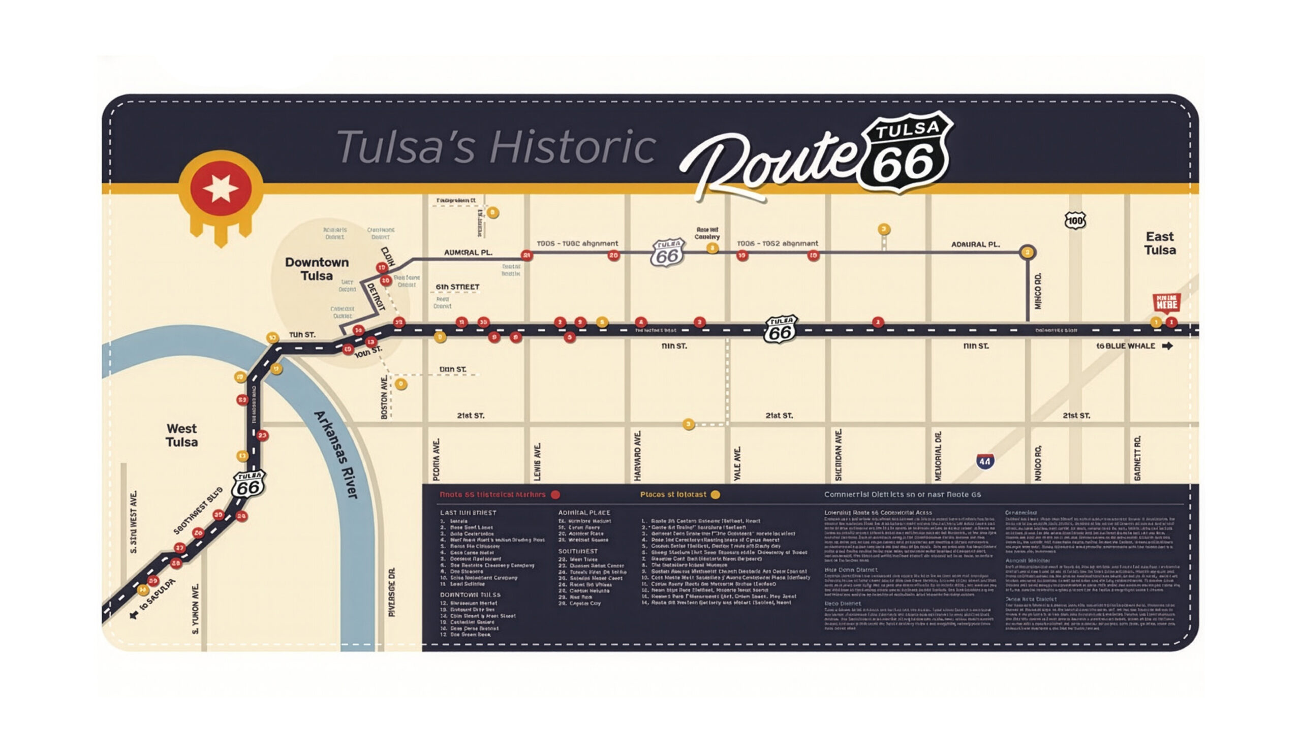
Along the 28 miles of historic highway that runs through its city limits, the recently titled ‘Capital of Route 66’ hosts several well-known hot spots, including the Meadow Gold Sign, the Golden Driller, and Mother Road Market. While some sites remain today, others have unfortunately been lost to time. For those interested in learning more about these locations, the Tulsa Route 66 Commission has created a map showcasing the 29 historical informational signs, along with other places of interest.
Each sign has a unique look, using old photographs, graphics, quotes, lyrics, and more to highlight the rich history neatly summarized on each sign.

For example, at the intersection of Admiral Place and Sheridan Road, one can find a historical marker detailing McIntyre Airport, the informal airfield that serviced the City of Tulsa before Tulsa International Airport was established. The sign includes photographs of Duncan McIntyre, the “Father of Tulsa Aviation,” along with pictures of the former airport. The text on the back of the sign features the recognizable lyrics from the song “Route 66,” famously sung by artists such as Nat King Cole, Chuck Berry, and the Rolling Stones.

Another spot across the street from the Blue Dome highlights the significance of the Green Book within the Tulsa area. The Green Book was a guide that informed African American travelers about where they were allowed to eat, sleep, do business, among other activities in the segregated South. This sign is a reminder of the diversity and the dark history that can be discovered along the Mother Road.

Hoffer added, “But you know what, that’s one of the reasons I moved back (to Tulsa). I really just wanted to do, you know, contribute and do some fun stuff around town.”
Residents and travelers alike now have the opportunity to learn more about Route 66 and Tulsa. A scavenger hunt awaits those who are either history buffs or simply want something fun to do in an afternoon. Whatever the case, adventure can be found in the “Capital of Route 66.”